Earth's Geography
and Climate
Explore how latitude, axial tilt, and atmospheric circulation shape Earth's diverse climate zones and biomes.
What is Climate?
Climate is the long-term average of weather patterns in a region, typically measured over 30 years or more. It differs from weather, which describes short-term atmospheric conditions at a specific time and place.
Axial Tilt: \(23.5^\circ\) That Changes Everything
Solar Intensity and Latitude
The angle of incidence determines how much solar energy a surface receives per unit area. At the equator, sunlight strikes nearly perpendicular, concentrating energy. At the poles, rays spread over a larger area, delivering less energy.
Atmospheric Circulation Cells
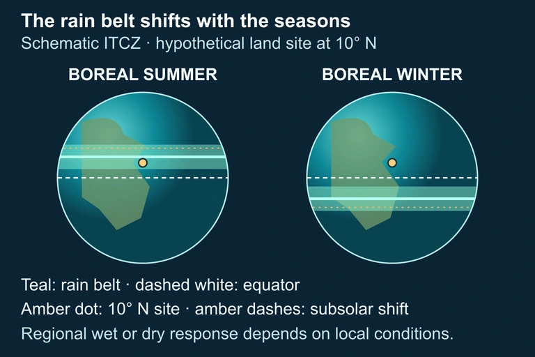
Explain why seasonal displacement of rainfall belts can create wet and dry seasons.
Use this illustration to explore the concept described in its caption.
The Coriolis Effect
Earth's rotation causes moving air and water to be deflected: to the right in the Northern Hemisphere, and to the left in the Southern Hemisphere. This deflection shapes wind patterns, ocean currents, and storm rotation.
Rain Shadows and the Orographic Effect
Key Distinction: Weather vs Climate vs Biome
Earth's Major Climate Zones
Climate zones are primarily determined by latitude and the resulting angle of solar insolation. The tropics receive the most energy, while the polar regions receive the least.
Ocean Currents and Heat Distribution
Ocean currents act as a global heat conveyor belt, transferring thermal energy from the tropics toward the poles. The thermohaline circulation is driven by differences in water temperature (thermo) and salinity (haline).
El Nino and La Nina
ENSO (El Nino-Southern Oscillation) is a periodic climate pattern in the tropical Pacific that affects weather globally. It alternates between two phases:
How to Analyze Climate Factors
Ocean influence and mountain lifting modify the same latitude
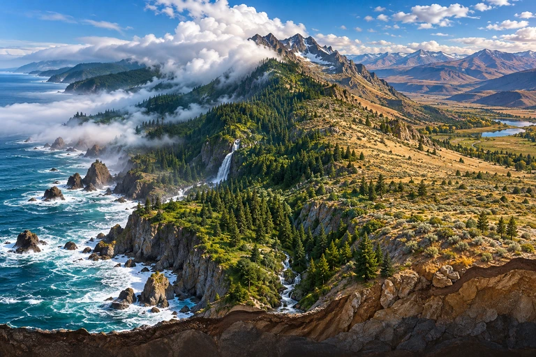 Ocean influence and mountain lifting can produce contrasting climates at the same latitude. A rain shadow develops when moisture-bearing air rises across a mountain and descends on the leeward side.
Wind and topography shape climate
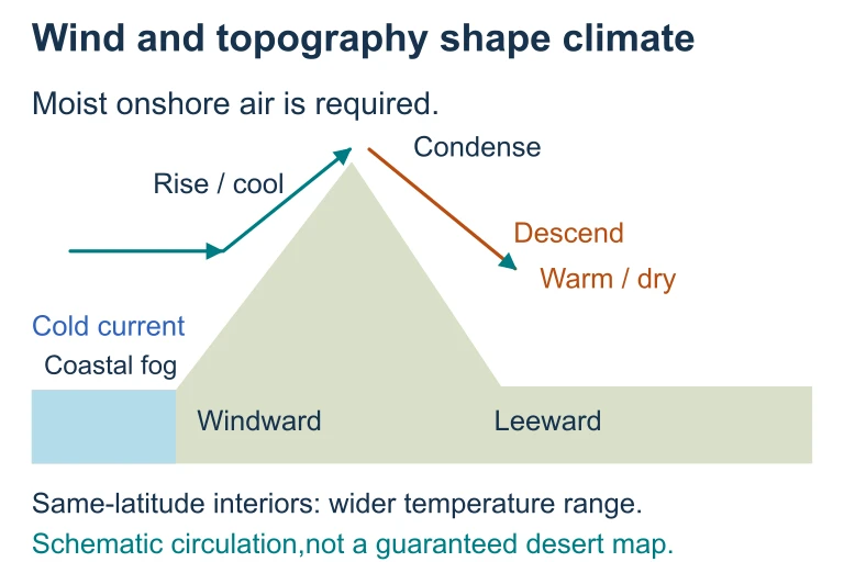 Ocean influence and mountain lifting can produce contrasting climates at the same latitude. A rain shadow develops when moisture-bearing air rises across a mountain and descends on the leeward side.
Example: Latitude and Temperature
Question: Why is Quito, Ecuador (\(0^\circ\) latitude, 2,850 m elevation) cooler than Miami, Florida (\(25^\circ\text{N}\), sea level), even though Quito is closer to the equator?
Example: Rain Shadow in the Pacific Northwest
Question: Seattle, WA receives ~950 mm of annual precipitation, while Ellensburg, WA (just 150 km east) receives only ~230 mm. Why?
Example: The Gulf Stream Effect
Question: London, UK (\(51.5^\circ\text{N}\)) has milder winters than Winnipeg, Canada (\(49.9^\circ\text{N}\)), despite being farther north. Why?
Common Mistakes
Climate Factor Summary
| Factor | Effect on Temperature | Effect on Precipitation |
|---|---|---|
| Latitude | Higher lat = cooler | Varies by circulation cell |
| Elevation | \(-6.5\,{}^\circ\text{C}\) per km up | More orographic rain at altitude |
| Ocean Currents | Warm currents warm coast, cold cool | Warm currents add moisture |
| Proximity to Water | Maritime: moderate; Continental: extreme | Coastal areas wetter |
| Rain Shadow | Minimal direct effect | Windward wet, leeward dry |
| ENSO | El Nino warms globally | Shifts rainfall patterns |
Question 1 of 5
Which of the following best explains why equatorial regions receive more solar energy per unit area than polar regions?
Question 2 of 5
A city at \(30^\circ\text{N}\) latitude on the western side of a continent is likely to have which climate characteristics?
Question 3 of 5
During an El Nino event, which of the following changes occurs in the tropical Pacific Ocean?
Question 4 of 5
Using the environmental lapse rate (\(\approx 6.5\,{}^\circ\text{C/km}\)), if the temperature at sea level is \(30\,{}^\circ\text{C}\), what is the approximate temperature at 3,000 m elevation?
Question 5 of 5
A coastal city warmed by a major ocean current has mild winters despite being at \(55^\circ\text{N}\) latitude. If that current were to weaken significantly, which outcome is most likely?