Distribution of Natural
Energy Resources
Explore how geological processes, climate patterns, and tectonic activity determine where fossil fuels, renewable sources, and minerals are found across the globe.
What Are Natural Energy Resources?
Natural energy resources are materials or phenomena found in the environment that humans harness to produce usable energy. They include fossil fuels formed over millions of years, radioactive minerals, and continuously renewed sources like sunlight and wind.
Why Distribution Matters
Energy resources are not evenly distributed across the planet. Geological history, latitude, topography, and climate create dramatic inequalities. This uneven distribution shapes geopolitics, trade networks, and environmental justice.
Geological Formation of Fossil Fuels
Petroleum systems require source, migration, reservoir and seal
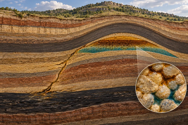 A petroleum system combines organic-rich source rock, migration pathways, porous reservoir rock and a trapping seal. Fluids occupy connected pore spaces within rock.
Conventional petroleum trap
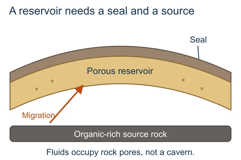 A petroleum system combines organic-rich source rock, migration pathways, porous reservoir rock and a trapping seal. Fluids occupy connected pore spaces within rock.
Key Factors Controlling Distribution
Renewable vs. Non-Renewable
| Renewable | Non-Renewable | |
|---|---|---|
| Replenishment | Continuous (human timescale) | Millions of years |
| Distribution driver | Climate, latitude, topography | Geological history, tectonics |
| Location flexibility | Broadly available (varies by type) | Concentrated in specific basins |
| Examples | Solar, wind, hydro, geothermal | Coal, oil, natural gas, uranium |
| Environmental impact | Low emissions, land use concerns | High emissions, habitat disruption |
Global Fossil Fuel Distribution
Solar Energy Distribution
Wind and Hydroelectric Potential
Wind lifts a blade and the nacelle reveals the conversion chain
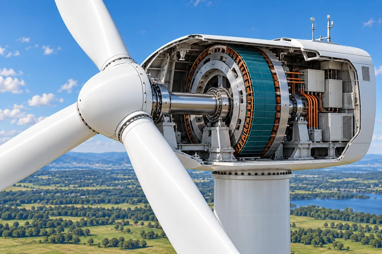 A 50 m rotor radius sweeps 7,854 m². At air density 1.225 kg/m³ and wind speed 8 m/s, available kinetic power is 2.463 MW; an assumed 40% overall efficiency gives 0.985 MW of electricity at that operating point.
Available and electrical wind power
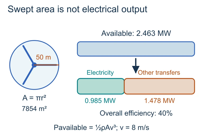 A 50 m rotor radius sweeps 7,854 m². At air density 1.225 kg/m³ and wind speed 8 m/s, available kinetic power is 2.463 MW; an assumed 40% overall efficiency gives 0.985 MW of electricity at that operating point.
Geothermal Energy and Tectonics
How to Analyze Resource Distribution
Example 1: Why Is Oil in the Middle East?
During the Mesozoic Era (252-66 million years ago), the Middle East was covered by a shallow tropical sea: the Tethys Sea. Massive marine organism die-offs created thick layers of organic-rich sediment. Burial and tectonic compression transformed this material into petroleum trapped under salt domes and anticlines.
Example 2: Solar vs. Wind Siting
A country at 55°N latitude with strong coastal westerlies and frequent cloud cover needs to choose between investing in solar farms or offshore wind. Which resource better matches its geography?
| Solar | Wind | |
|---|---|---|
| Latitude factor | Low angle, short winter days | Strong mid-latitude westerlies |
| Cloud cover | Reduces output significantly | Wind unaffected by clouds |
| Coastal advantage | Minimal | Offshore wind farms ideal |
| Verdict | Poor match | Strong match |
Example 3: Energy Density Comparison
Energy density determines how much land or material is needed to produce a given amount of power. This affects which resources are practical in land-scarce vs. land-abundant regions.
Common Mistakes
Summary: Energy Resources at a Glance
| Resource | Distribution Driver | Key Regions |
|---|---|---|
| Oil | Sedimentary basins, ancient seas | Middle East, Russia, N. America |
| Coal | Ancient swamp forests | China, U.S., India, Australia |
| Natural Gas | Sedimentary basins, shale deposits | Russia, Qatar, U.S., Iran |
| Solar | Latitude, cloud cover, aridity | Sahara, Arabia, Outback, SW U.S. |
| Wind | Pressure gradients, coastlines | N. Europe, Great Plains, Patagonia |
| Hydro | Precipitation + elevation | Brazil, Canada, Norway, China |
| Geothermal | Plate boundaries, hotspots | Iceland, Philippines, U.S. West |
Question 1 of 5
Which geological factor best explains why the Middle East has the largest proven oil reserves?
Question 2 of 5
A country at 60°N latitude with strong prevailing westerlies and persistent cloud cover would find the greatest energy potential in which resource?
Question 3 of 5
Geothermal energy is most concentrated in regions that are:
Question 4 of 5
Which statement about power density of energy resources is most accurate?
Question 5 of 5
Brazil generates over 60% of its electricity from hydroelectric dams. Which combination of geographic factors best explains this?